Problem Statement
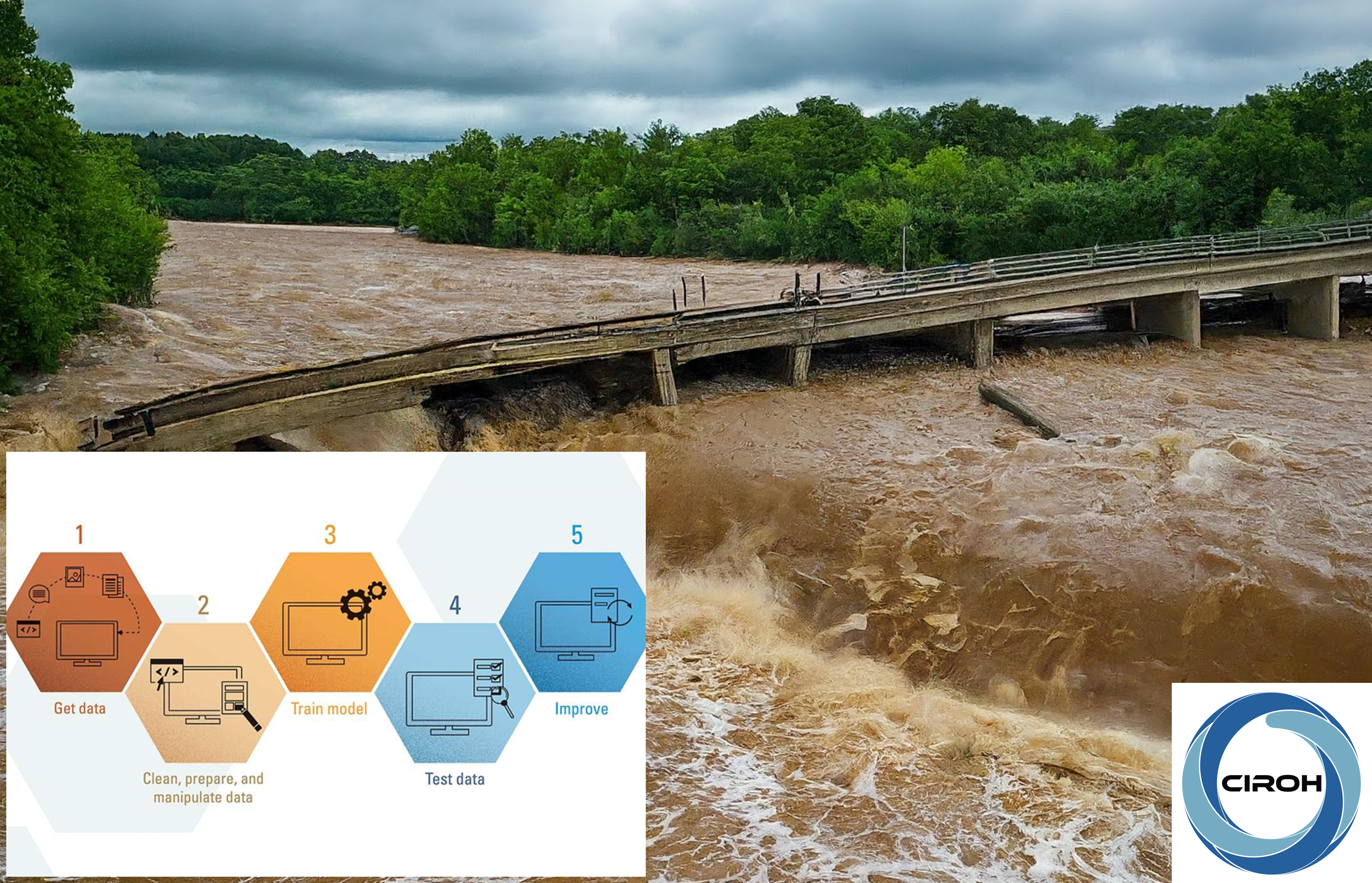
In the U.S., the hydraulic collapse frequency is estimated at 0.02% per year for a total population of about 504,000 bridges. One such collapse occurred at the intersection of Bear Cabin Branch and Grafton Shop Road (Latitude 39.54491 and Longitude -76.3924) in the City of Bel Air North, MD. As a hydrologic and hydraulic engineer, you are tasked with making a decision on hydraulic design to create a more resilient and sustainable bridge in the future. The goal is to utilize a flood inundation map generated through machine learning to aid in this process. You will need to create a flood inundation map for the collapse site using machine learning techniques, and then compare and evaluate this map against existing physically based models. These flood inundation maps will be utilized in determining specific design elements for the new hydraulic bridge.
Module Overview
This module focuses on teaching the knowledge and technical skills related to flood inundation mapping and its impact on designing resilient and sustainable hydraulic infrastructure. It consists of the following sections:
- Section 1: Introduction
- Section 2: Machine Learning for Flood Inundation Mapping
- Section 3: Evaluation of Flood Inundation Mapping
- Section 4: Decision Making for Hydraulic Design
Topics Covered
Flood Hazard Data, Machine Learning for Flood Inundation Mapping, Resilient vs. Sustainable Hydraulic Design
Prerequisites
The student needs to have basic understanding of
Learning Objectives
At the end of this module, students will be able to download FEMA flood hazard data, train a machine learning model for flood inundation mapping, and examine flooded areas for resilient vs. sustainable hydraulic design.
This will be accomplished through activities within each section. Results from each activity will be recorded in specified results templates. The results templates for each activity can be found at the beginning of each activity. The results templates are organized such that results from one activity can easily be used in successive activities.
Suggested Implementation
This module was designed to be self-paced and the student should be able to complete each section following detail instructions.
Course Authors
Huidae Cho
Associate Professor, New Mexico State University
Dr. Huidae Cho is a Professional Engineer (PE) licensed in Maryland, Member of the American Society of Civil Engineers (M.ASCE), Certified Floodplain Manager (CFM), and Certified GIS Professional (GISP). He is an avid Open-Source advocate and enjoys scientific programming to solve computational problems. He has been part of the Geographic Resources Analysis Support System (GRASS) development team since June 2000, is a member of the GRASS Project Steering Committee, and has special interests in developing and contributing geospatial modules to the Open-Source community. He is also a senior ArcGIS developer.
Email Address: hcho@nmsu.edu
Fahmidah Ashraf
Assistant Professor, Bradley University
Dr. Fahmidah Ashraf serves as an assistant professor in the Department of Civil Engineering and Construction at Bradley University in Illinois. Before joining Bradley University, she conducted postdoctoral research at Virginia Tech, where she explored the effects of regional climate-hydrological trends, collaborating with Stanford University. In 2017, she was chosen as an ASTRO Fellow at Oak Ridge National Lab, where she delved into climate change and its impact on transportation infrastructure. In her teaching role, she integrates her research insights and professional background. Notably, she emphasizes real-world problem-based learning approaches. As a teacher, she aims to instill a sense of professional responsibility among students, enhance their outlook, and provide the opportunity to learn about challenges associated with real-life scenarios. Over the years, she has taught courses including Fluid Mechanics, Surface Water Hydrology, Groundwater Hydrology, Water Supply and Hydraulic Engineering, and Numerical Methods.
Email Address: fashraf@bradley.edu
Kshitij Dahal
Graduate Student, Arizona State University
Kshitij Dahal is a natural hazards scientist with over five years of research and academic experience across Nepal, and the United States. He is currently a WaterDMD PhD student at the School of Sustainable Engineering and the Built Environment (SSEBE), Arizona State University. His research focuses on data-driven hydrology, geospatial decision support systems, and the application of Earth observation and machine learning for sustainable development. Prior to joining ASU, Kshitij served as a researcher and assistant lecturer in Nepal, contributing to natural hazards research and civil engineering education. He is a Community Science Fellow at the American Geophysical Union and actively involved in interdisciplinary science communication and capacity-building initiatives.
Email Address: kdahal3@asu.edu
Target Audience
The target audience of this module is senior undergraduate and/or graduate students in Civil Engineering.
Expected Effort
The module developers estimate that this module will take between 10 to 14 hours to complete.
Course Sharing and Adaptation
This course is available for adaptation and customization by other instructors. A compressed copy of this course can be downloaded from the course about page in the top right hand corner by clicking the "Export Link" link. You will need a HydroLearn instructor studio account to do this. You will first need to sign up for a hydrolearn.org account, then you should register as an instructor by clicking 'studio.hydrolearn' and requesting course creation permissions.
Recommended Citation
Cho, H., Ashraf, F., Dahal, K. (2024). Flood Inundation Mapping Using Machine Learning for Sustainable vs. Resilient Design.
CIROH. https://edx.hydrolearn.org/courses/course-v1:NMSU+CE483+Fall2024/about
Review
This module was submitted on 9/18/2024 and was completed on 4/22/2025 after a peer review and a revision.
Acknowledgement
This project received funding under award NA22NWS4320003 from NOAA Cooperative Institute Program. The statements, findings, conclusions, and recommendations are those of the author(s) and do not necessarily reflect the views of NOAA.