
Austin Polebitski
Assoc. Professor, Civil and Environmental Engineering, University of Wisconsin Platteville
polebitskia@uwplatt.eduUW_Platteville
This course introduces students to floodplain analysis through a hands-on application to the Pecatonica River near Darlington, WI. Students will learn how to collect and analyze watershed data, apply statistical concepts to perform flood frequency analysis, and perform a floodplain analysis using HEC-RAS while considering input/output uncertainty and a cost analysis of design alternatives.
Water resources engineers are frequently required to protect people and property from the impacts of flooding. In order to determine the depth of flood waters and to determine the size or width of floodplains, engineers must first examine both the hydrology and hydraulics of the watershed to determine the amount of water that will reach a stream and how it will be propogated down the channel and across the floodplain.
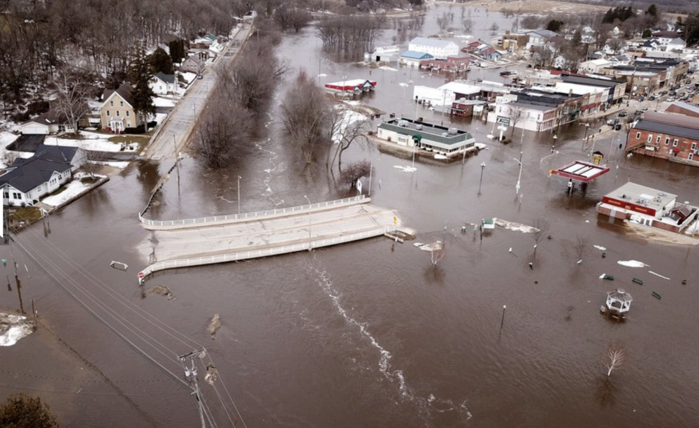
When making decisions about the best ways to prevent flood damages, government officials, engineers, and community residents need to know the water elevation to plan for, essentially asking how high will the river rise during a flood? In this module, a case study will consider Darlington, WI, a town that experienced significant flooding in the spring of 2019, along with many parts of the Upper Midwest and states bordering the Mississippi River.
This module addresses fundamental topics in hydrology and hydraulics through a real-world application of floodplain analysis on the Pecatonica River near Darlington, WI. These key water resources topics include the application of the principles of watershed hydrology (where does water go in the watershed, by what pathway, and for how long), where to find data required for floodplain analysis, the theoretical underpinnings used to analyze gradually varied flow conditions, and the development of a HEC-RAS model to simulate flood extents for different return period discharges.
This will be accomplished through learning activities within each section. Results from each activity will be recorded in results templates. The results templates for each activity can be found at the beginning of each activity.
N/A
At the end of this module, students will be able to:
This will be accomplished through activities within each section. Results from each activity will be recorded in results templates. The results templates for each activity can be found at the beginning of each activity.
Assoc. Professor, Civil and Environmental Engineering, University of Wisconsin Platteville
polebitskia@uwplatt.edu
Assoc. Professor, Civil and Environmental Engineering, Clarkson University
tsmith@clarkson.eduJunior/Senior Hydrology and Water Resources Engineering Courses
Computer with access to Internet, Excel, and HEC-RAS software [free]
This course is available for export by clicking the "Export Link" at the top right of this page. If you are an Instructor seeking the answer keys, please contact the course creators using your official University email account.
For split hydrology / hydraulics courses: We recommend considering Sections 1+2 during your hydrology course and Sections 3+4 during your open channel hydraulics course.
For changing the study location: We recommend identifying a location that can be delineated using StreamStats (streamstats.usgs.gov/ss), has discharge data available on NWIS (maps.waterdata.usgs.gov/mapper), FEMA FIRM maps (msc.fema.gov), and available topographic survey data.
Polebitski, A. and Smith, T. (2020). Introduction to Floodplain Analysis. HydroLearn. https://edx.hydrolearn.org/courses/course-v1:UW_Platteville+CEE4300+F2020/about
A student could expect to complete this module with approximately 25 work hours.