Problem Statement
The global rise in flood events, driven by climate change, environmental challenges, and rapid urbanization, has heightened the need for large-scale Flood Inundation Mapping (FIM). During extreme flood events, emergency managers and forecasters must quickly determine which areas are inundated, which critical infrastructure is at risk, and where to prioritize response efforts. Traditional hydrodynamic flood models can provide detailed flood predictions, but they often require substantial computational resources, specialized expertise, and long simulation times, making them challenging to use for rapid decision-making.
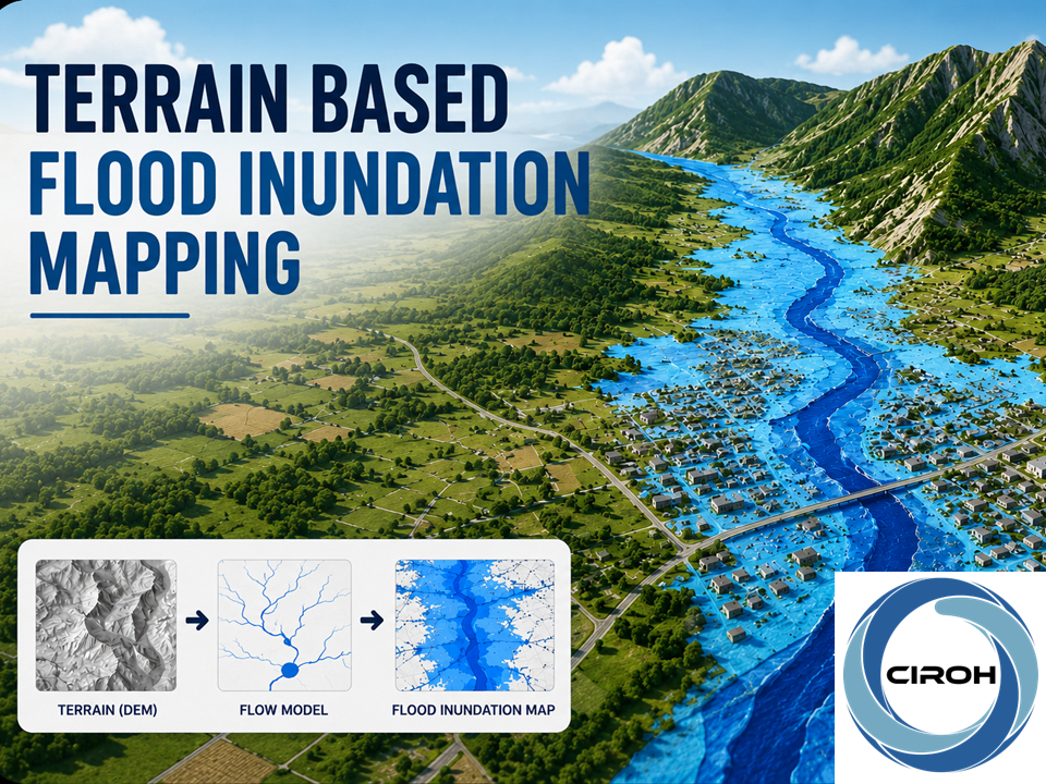
Terrain-based flood inundation mapping offers a computationally efficient alternative for generating flood extent maps over large geographic regions. By utilizing topographic data and streamflow information, these methods can efficiently estimate flood extents across large regions while requiring substantially fewer computational resources. Despite their computational efficiency, terrain-based methods rely on simplifying assumptions and parameter choices that influence mapping accuracy. Therefore, understanding the workflow, data requirements, assumptions, and limitations of terrain-based flood mapping is essential for producing reliable flood inundation maps and supporting informed decision-making during flood events.
Module Overview
This module provides the skills needed to use the terrain-driven Height Above Nearest Drainage (HAND) approach for efficient, low-overhead Flood Inundation Mapping (FIM). By integrating Synthetic Rating Curves (SRCs) with retrospective and real-time streamflow data from the NOAA National Water Model (NWM), participants can model historical flood events. The course connects the principles of open-channel hydraulics with automated geospatial processes necessary to prepare the terrain-based model, culminating in a practical emergency management simulation. In this final exercise, learners evaluate parametric uncertainty to determine critical evacuation boundaries and safeguard essential infrastructure during a major hurricane scenario.
Topics Covered
- Foundations of open-channel hydraulics.
- Conceptual and structural framework of the HAND mapping approach.
- Hydroconditioning techniques for raw digital elevation datasets.
- Building and modifying the Synthetic Rating Curve (SRC) for flood map generation.
- Querying, downloading, and interpreting NWM streamflow products.
- Flood inundation mapping using the Height Above Nearest Drainage (HAND) approach and critical infrastructure detection.
Prerequisites
The learners need to have a basic understanding of the following topics. Supporting resources are linked for each.
Learning Objectives
At the end of this module, learners will be able to:
- Interpret the sequential components of the Height Above Nearest Drainage (HAND) approach.
- Quantify the impact of Synthetic Rating Curves (SRCs) on flood inundation extents.
- Explain the source of data for flowlines, terrain, and streamflow, and how they are physically connected in the HAND FIM model.
- Given the watershed dataset and Python code, analyze how variations in the HAND model parameters impact the flood extents.
- Using a flood inundation map, distinguish between inundated and non-inundated zones and identify at-risk communities and infrastructure.
This will be accomplished through activities within each section. Results from each activity will be recorded in specified results templates. The results templates for each activity can be found at the beginning of each activity. The results templates are organized so that results from one activity can be easily used in subsequent activities.
Course Authors
Supath Dhital
Supath Dhital is a researcher at the University of Alabama, USA, specializing in geospatial data science, hydrology, and hydroinformatics. His research focuses on GIS, remote sensing, GeoAI, flood modeling, spatial data analysis, and the development of open-source scientific tools. He works on integrating geospatial technologies, hydrological modeling, and computational workflows to develop reproducible and scalable solutions for flood mapping and water resources management. His work aims to support researchers, planners, and decision-makers through accessible geospatial tools and data-driven applications.
Dipsikha Devi, PhD
Dr. Dipsikha Devi is a Postdoctoral Researcher in the Department of Geography and the Environment at the University of Alabama, USA. She earned her Ph.D. in Water Resources Engineering from the Indian Institute of Technology Guwahati, India. Her research focuses on flood inundation mapping, hydrological and hydraulic modeling, remote sensing, GIS, and flood risk assessment. Her work integrates geospatial technologies, computational tools, and hydrological modeling to advance flood forecasting and management.
Solution Keys
Completed results templates for each learning activity are available at the end of the module.
Target Audience
This training module is tailored for undergraduate and graduate students, professional hydrologists, operational water resource managers, hazard planners, and emergency management personnel seeking to understand rapid, accessible, and low-cost flood-inundation modeling workflows to inform emergency safety decisions.
Expected Effort
The module developers estimate that this module will take between 3 and 5 hours to complete.
Course Sharing and Adaptation
This course is available for export by clicking the "Export Link" at the top right of this page. You will need a HydroLearn instructor studio account to do this. You will first need to sign up for a hydrolearn.org account, then you should register as an instructor by clicking 'studio.hydrolearn' and requesting course creation permissions.
Recommended Citation
Dhital, S., & Devi, D. (2026). Terrain-based Flood Inundation Mapping. HydroLearn. CIROH. https://edx.hydrolearn.org/courses/course-v1:CIROH_HydroLearn+SDML_01+2026/about
Acknowledgement
This project received funding under award NA22NWS4320003 by the National Oceanic and Atmospheric Administration (NOAA) Cooperative Institute Program to the Cooperative Institute for Research on Hydrology (CIROH) through the University of Alabama. The statements, findings, conclusions, and recommendations are those of the author(s) and do not necessarily reflect the opinions of NOAA.