Problem Statement
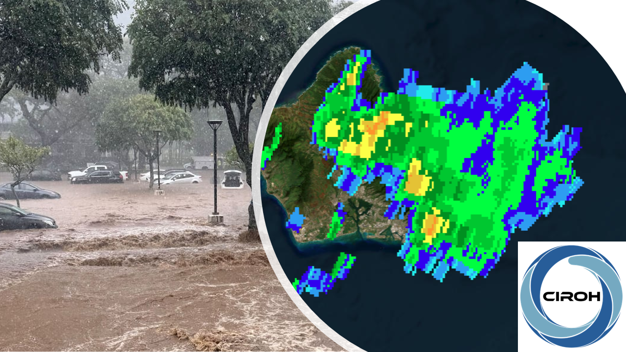
Flash floods are among the most costly natural hazards in the United States, yet predicting which storms and the associated rainfall will produce catastrophic flooding remains a challenge. Rainfall naturally varies across a watershed, with storms shifting in their location, intensity, and overall coverage—yet flood forecasting and emergency response decisions often focus primarily on the total rainfall accumulation, overlooking the role of rainfall spatial characteristics in driving streamflow response. Two storms delivering comparable total rainfall to the same saturated watershed can produce dramatically different flood outcomes. An example of this was demonstrated by the back-to-back storms that struck Mānoa Valley, Oʻahu in March 2026, only one of which caused catastrophic flooding.
Module Overview
This module provides learners the opportunity to explore the spatial variability of rainfall and its association with flood responses in watersheds. It equips operational hydrologists and forecasters with the technical skills and conceptual framework needed to analyze rainfall spatial characteristics using MRMS gridded data and Python.
Topics Covered
Rainfall spatial characteristics (area-averaged rainfall, heavy rainfall area fraction, connectivity, and rainfall distance to the outlet), accessing Multi-Radar Multi-Sensor (MRMS) rainfall and rain rate data, converting data formats (GRIB2 to NetCDF), and visualizing MRMS data.
Prerequisites
Before starting this module, learners should have:
- Intermediate programming knowledge in Python (handling large-scale geospatial data, familiarity with xarray and multidimensional array manipulation).
- Basic understanding of data formats (GRIB2, NetCDF, GeoTIFF, geojson, shapefile, csv, etc.).
- Familiarity with HydroShare and Jupyter Notebooks.
For foundational material, learners are encouraged to review the following modules:
Learning Objectives
At the end of this module, learners will be able to:
- Interpret rainfall spatial characteristics
- Describe Multi-Radar Multi-Sensor (MRMS)
- Create maps for Multi-Radar Multi-Sensor (MRMS) precipitation data for any specified watershed
- Compute rainfall spatial characteristics from MRMS for any given storm event
- Evaluate how rainfall spatial metrics may contribute to variability in stream peak flow from different storms
Course Authors
Yu-Fen Huang, PhD
University of Hawaiʻi at Mānoa
yfhuang@hawaii.edu
Junior Researcher at University of Hawaiʻi at Mānoa (Tsang Stream Lab). Her research focuses on flash flood forecasting, extreme rainfall analysis, and hydrological modeling for tropical islands. She is also interested in stream stage nowcasting for outreach activities, stream temperature and sediment modeling to surpport aquatic ecological research, and conservation hydrology (e.g., how removing invasive plants affects flooding) to explore more natural options to protect watersheds.
Francisco Gomez, PhD
University of Kansas
francisco.gomez@ku.edu
Postdoctoral Researcher at the University of Kansas. His research focuses on compound flood modeling during hurricane events, river and estuarine hydrodynamics, and morphodynamic modeling. He is also interested in remote sensing technologies, advanced machine learning, and numerical modeling frameworks to solve complex water-related challenges and improve environmental forecasting.
Target Audience
Operational hydrologists and forecasters, and graduate students in Meteorology and Hydrology-related fields.
Expected Effort
The module developers estimate that this module will take between 3 to 5 hours to complete. Please note that the individual section estimates shown under the course outline are calculated automatically based on word count and may not perfectly reflect the actual time required.
Course Sharing and Adaptation
This course is available for export by clicking the "Export Link" at the top right of this page. You will need a HydroLearn instructor studio account to do this. You will first need to sign up for a hydrolearn.org account, then you should register as an instructor by clicking 'studio.hydrolearn' and requesting course creation permissions.
Recommended Citation
Huang, Y., & Gomez, F. (2026). Rainfall Spatial Characteristics and Their Impact on Hydrology. HydroLearn. https://edx.hydrolearn.org/courses/course-v1:UH+HL401+2026_S2/about
Acknowledgement
This project received funding under award NA22NWS4320003 by the National Oceanic and Atmospheric Administration (NOAA) Cooperative Institute Program to the Cooperative Institute for Research on Hydrology (CIROH) through the University of Alabama. The statements, findings, conclusions, and recommendations are those of the author(s) and do not necessarily reflect the opinions of NOAA. We express our sincere gratitude to our mentor, Yinphan Tsang, for her invaluable feedback and suggestions. We also thank the HydroLearn team—particularly Cathrine Maiorca, Courtney Di Vittorio, Megan Burton, Ryan Johnson, and Summer Conley—for sharing their expertise in asynchronous education, providing content feedback, and offering administrative support.