Gentilly Resilience District
The Gentilly Resilience District in New Orleans, Louisiana, is an innovative and creative approach to revitalizing neighborhoods in the district and implement projects aimed at supporting social, cultural, and environmental resilience. The US Department of Housing and Urban Development (HUD) awarded the city of New Orleans a grant to implement green infrastructure projects in the Gentilly neighborhood now known as the Gentilly Resilience District to demonstrate how cities can adapt existing systems and utilize green infrastructure to deal with water challenges (Lewis). The city’s first-ever Resilience District will be a model for how other neighborhoods in New Orleans, across the region, and across the country, can adapt to thrive in a changing environment; by using various approaches to water and land management that have been successfully piloted throughout New Orleans and, when implemented together, are intended to create even greater neighborhood benefits—such as improved health, economic opportunity, environmental education, and recreation.
The Gentilly Resilience District includes seven distinct projects in the area (Figure 1) with the goals to:
- reduce flood risk
- slow land subsidence,
- improve energy reliability
- revitalize the neighborhoods

St Anthony Green Streets
One of the seven proposed projects is the St. Anthony Green Streets project, a community-scale redesign of neighborhood streets and parks with green infrastructure or low impact development (LID) to reduce historic flooding problems due to stormwater runoff (Figure 2). Design and construction of green infrastructure projects such as bio-swales, bio-retention filters, vegetative filter strips, rain gardens, pervious pavements, green roofs, etc. are increasing in communities across the nation. The concept of green infrastructure, based on the natural flow of stormwater, is not a new one, but has become popular in recent years due to urban problems associated with flash flooding from high intensity short duration rainfall events. These events are increasing as a result of climate change and have caused increasing concern over polluting our nation’s water bodies with non point source runoff.
This particular project is under design by Batture, LLC. The St. Anthony Green Streets Project is a redesign and retrofit of six residential streets and two neighborhood parks within the St. Anthony neighborhood. The St. Anthony Green Streets project is divided into three sections; South, Middle, and North, with design plans underway for roadway surface reconstruction, full roadway reconstruction, and proposed green infrastructure around roadways and within and around existing parks.
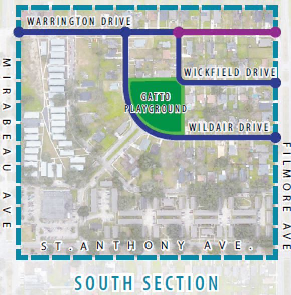
Figure 2. Vicinity map of the South section St. Anthony Green Streets project.
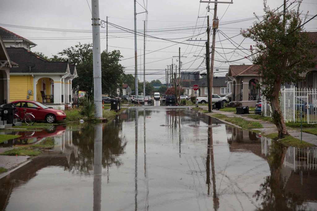
Figure 3: Typical flooded street in the Gentilly neighborhood.
Project organizers have made great efforts to include the community in the planning and design of LID (Figure 4). Click on the image in Figure 3 below to watch a video of a community tour of the project sites that was an element of the outreach efforts. The video and tour was produced by the Arts Council of New Orleans.
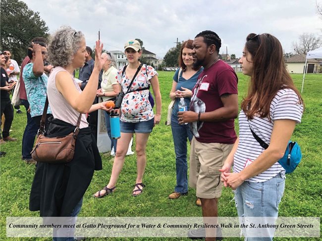
Figure 4: Community members meet at Gatto Playground for a Water & Community Resilience Walk in the St. Anthony Green Streets. Source: https://www.nola.gov/resilience-sustainability/green-infrastructure
The information and images below are adapted from materials produced by the design engineers for the project. Source: https://www.nola.gov/getattachment/Resilient-New-Orleans/NDR-GRD-Projects-Programs/St-Anthony-Green-Streets/NDR002_St-Anthony-Overview-Fact-Sheet_2021.pdf/?lang=en-US
Gatto Park proposed reconstruction design:
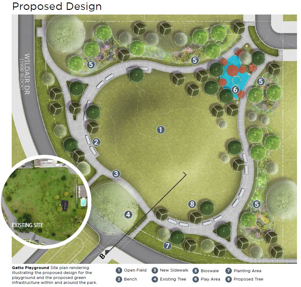
The learning activities in Sections 3 and 4 of this module will be centered around a portion of the St. Anthony Green Streets project in an area we will refer to as the Gatto Park Neighborhood. The watershed is defined by the outlet at the intersection of Filmore Ave. and Wildair Dr. An interactive map of the watershed is shown below, identifying the boundary of the site as well as the proposed location of low impact development (LID).
Figure 5: Interactive Google MyMaps of the South section of the St. Anthony Green Streets project. https://www.google.com/maps/d/viewer?mid=1b04lrZIdQPlxTRaECfQpHGVoXu3QU0Ia&ll=30.01038821402197%2C-90.0680744&z=18
More details are available in this linked fact sheet: St-Anthony-Green-Streets/20_04_09_St-Anthony-Overview-Fact-Sheet.pdf
Although not necessary for this particular module, there is a detailed drawing of the original storm sewers is provided below. The schematic identifies pipe sizes and connectivity as well as the locations of curb inlets. This information is required if you were to extend your analysis to include a hydraulic model of the area.
Figure 6: New Orleans Sewerage and Water Board subsurface drainage map of the Gatto Park area.
This page is adapted from the nola.gov website for the City of New Orleans: https://www.nola.gov/resilience-sustainability/areas-of-focus/green-infrastructure/national-disaster-resilience-competition/gentilly-resilience-district/