Problem Statement
Extreme rainfall events often lead to flooding, and the major challenge is estimating how much rainfall is converted into runoff. During intense precipitation, the distribution of rainfall between infiltration into the soil and surface runoff flowing across the land surface largely determines the magnitude of flooding. This process is affected by several factors, including soil type, antecedent moisture conditions, and infiltration capacity. Understanding how these soil and landscape characteristics influence hydrological responses during extreme weather events is therefore essential for improving flood prediction and watershed management.
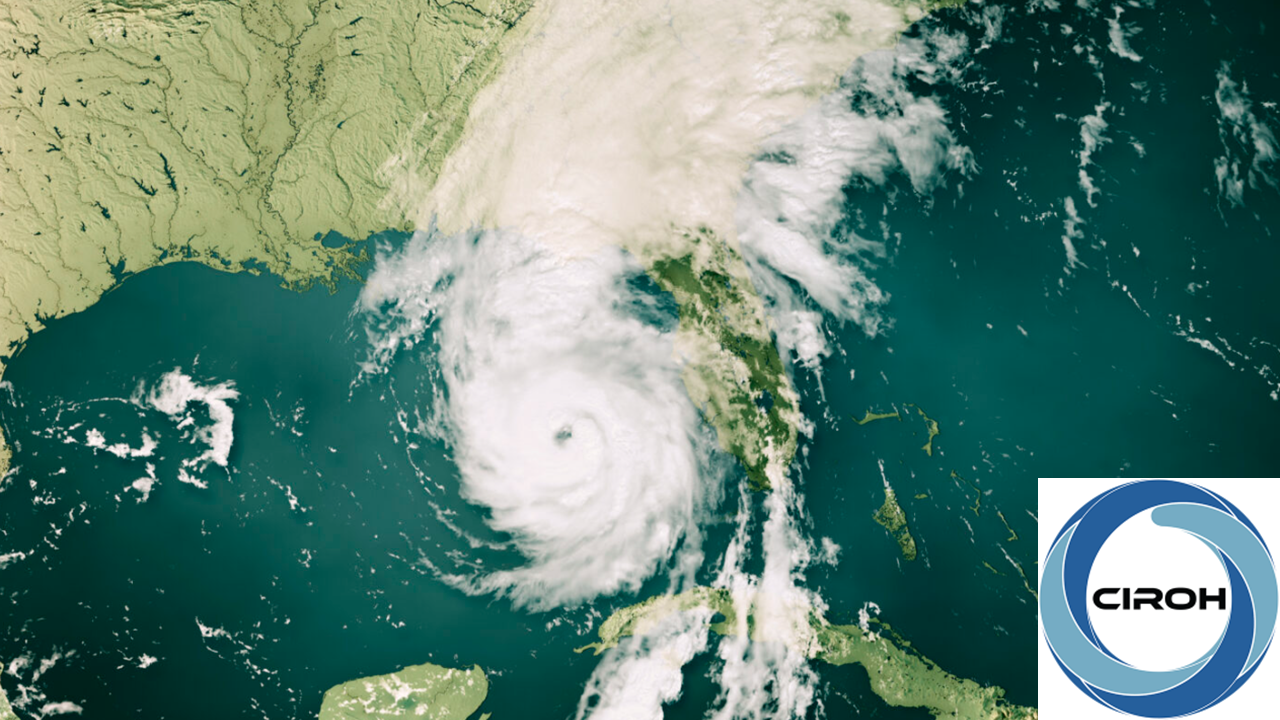
Hurricane Helene, which impacted the Asheville, North Carolina, region in September 2024, caused intense rainfall and high runoff across the landscape. The event led to vulnerabilities within the watershed system and highlighted the importance of understanding how extreme precipitation interacts with soil and land surface processes. Such events allow us to better understand how hydrological processes respond under extreme conditions and contribute to flood risk.
Accurately forecasting floods requires reliable estimation of runoff generated from rainfall. Hydrological approaches such as the Green–Ampt infiltration model help quantify how soil properties and soil saturation conditions influence the balance between infiltration and surface runoff. By examining how rainfall is converted into infiltration, subsurface flow, and runoff, hydrologists can better understand watershed behavior during extreme events.
Module Overview
This module examines how extreme rainfall events lead to runoff and streamflow within a watershed, using Hurricane Helene as a case study. Predicting floods requires an understanding of how rainfall is distributed between infiltration into the soil and surface runoff. This module focuses on the key hydrological processes that control this partitioning, particularly the role of soil properties, infiltration capacity, and antecedent moisture conditions.
Learners will explore how these factors influence the movement of water through and across the landscape during intense storms. Using Hurricane Helene as an example, learners will analyze how extreme precipitation can produce high runoff and increase flood risk within a watershed.
The module consists of Green–Ampt infiltration method, which is a physically based approach for estimating infiltration and runoff based on rainfall intensity and soil hydraulic properties. Through this analysis, the module helps learners understand watershed responses to extreme precipitation and how this knowledge supports improved flood prediction and watershed management.
Target Audience
The module is ideal for Operational Hydrologists seeking practical experience of runoff generation and assessing flood potential during the extreme events
Tools Needed
- Microsoft Excel: For input data handling
- Python: Python implemented using Jupyter Notebook
Suggested Implementation Mode
The intent of this module is to bring together different concepts and techniques typically covered in hydrology courses using a real-world case study with an actual hydrologic flood problem. The module is designed in such a way that hydrologist should be able to complete all activities on their own and each activity has its own worksheet for analyzing progress and knowledge acquired from the module.
- Practical Application: The module motivates the learner to collect specific hydrologic datasets to analyze the hydrologic responses to extreme rainfall events for a specific region.
- Quantitative Analysis: The module supports the quantitative analysis of the effects of different soil types and infiltration parameters on an extreme rainfall driven flood event.
Expected Completion Time
4-5 hours is a reasonable timeframe for a learner to complete the entire module.
Course Adaptation
This course was adapted from HydroLearn413: "Quantifying Runoff Generation": https://edx.hydrolearn.org/courses/course-v1:HyrdoLearn+HydroLearn413+2020_S2/about
This course is available for adaptation and customization by other instructors. You can request a link to download a copy of the course and import it back into your own new HydroLearn course.